An uplifting post for 'Blue Monday', featuring a trip on the canal with the Peter le Marchant Trust
Back in 2004, a travel company created a marketing campaign centred around the idea that somehow the third Monday in January was the saddest and most depressing day of the year, arriving as it does, with the Christmas-overspending credit card bills, after at least two full weeks back at work (if you were lucky enough to have a break), and after spending precious time with family and friends (if you were lucky enough to do so). The weather, at this time, is also quite likely to be a bit overcast, which might further dampen some spirits. But, despite the elaborate mathematical equations that went behind the creation of the marketing ploy, the idea of there being one day - ‘Blue Monday’ – that is more depressing than any other day, is not supported by everyone, and indeed, some organisations believe this concept is actually harmful. There are many websites out there which explain the concept and comment upon it – Wikipedia, and livescience.com are but two.
As for me? Well,
I have highs and lows, I have periods of happiness and periods of sadness, most
of which seem to be related to events or situations that can happen at any
time, and I don’t necessarily feel ‘blue’ on ‘Blue Monday’. Strategies for
dealing with this usually include getting myself outside for a walk – whatever the
weather! I am happy walking around the local housing estates, through fields,
in woods, or along canal towpaths – anywhere really! And I’m lucky enough to be
able to do this.
 |
| Over the canal bridge! |
The local canal is a go-to place, not just for a leisurely walk, but also as a route into town, which avoids busy and noisy roads, providing instead a walk through nature, with the sound of water as an accompaniment – the leaky lock, the wash of a passing vessel, the splash of the canoeist’s oars, the trickle of water flowing into the brook. I do, however, understand that not everyone can walk this beautiful route, but there are other ways to appreciate this environment.
Over the
years I have had many canal boat holidays, across many different canals to many
different places – a long trip from Mountsorrel to Oxford springs to mind, as
does a trip from Sawley Marina to Lincoln, and one from St Neots to Cambridge.
I’ve also been on lots of day trips, or half-day trips, many in the local area,
but further afield too – like Stratford.
 |
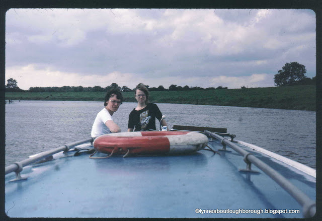
| With a friend on one of the many extended boat trips over the years |
Last summer I was very lucky to be able to join a canal boat trip from Loughborough to Mountsorrel. I’d known of the Peter le Marchant Trust since the very early 1980s, when they were based on Derby Road, just under the Belton Road bridge (No.40), and regularly passed their distinctive boats on my trips along the canal.
 |
| The former base on Derby Road just beyond the bridge (left) |
You can read about the history of the Trust, and about what they do over on their website.
I never thought I’d qualify to be one of those people travelling on one of the Trust’s boats – Symphony, Sonata, Serenade etc. – until the pandemic of 2020 changed this, and the Trust opened up their trips to anyone. Perhaps it was recognised that a relaxing trip along the canal, seeing and hearing the wildlife, chatting to other travellers, while drinking cups of tea and eating a sandwich, could be of benefit to everyone.
The four-hour trips leave from the Trust’s base on Beeches Road, and travel either in the direction of Loughborough, or Mountsorrel. On the day of my journey, we left Canalside Moorings around 10am, and headed out towards Barrow. Even while we were preparing to leave, we were treated to a visit by the local pair of swans with their six fluffy cygnets, conditioned by the regularity of the boat trips, to know when there were rich pickings to be had!!
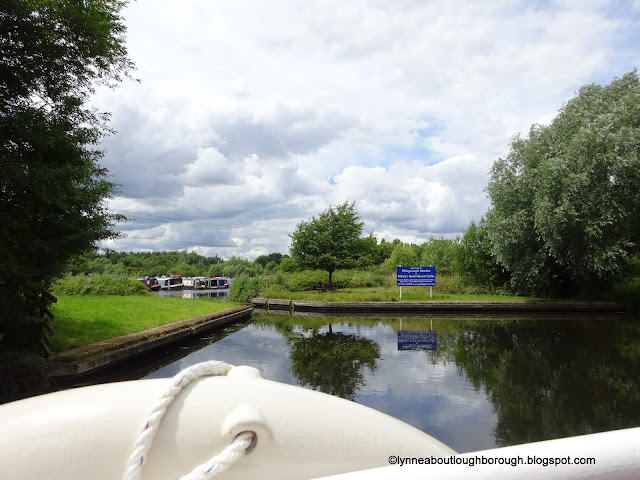
Once aboard (I chose to sit up front) it was fascinating to watch the experts turn the huge Symphony, for their trip to Loughborough. The phutt-phutt-phutt of the Lister diesel engine was as familiar to me as the chug-chug-chug of the steam engine, and I could feel the vibration of the engine through my chair and my feet!
Almost immediately we
set off on Serenade, we caught sight of a black-headed gull in flight across the
canal. We were reminded that although we often refer to similar birds as seagulls,
there is actually no such thing, so these we saw here (and there are loads at
Charnwood Water) were the black-headed variety of gull, while the ones at the
seaside, are herring gulls.
Incidentally, it was also on this early part of the journey that I was reminded that the Leicestershire Industrial History Society were doing guided tours of the GlenfieldTunnel. I shouldn’t have needed to be reminded since I’ve been a member of that Society for 10 years, but I did need to be reminded that tunnel tours are staffed solely by members of the Society, and it was about time I did my stint!
Anyway, back to the canal, and sitting on the little bridge (No.34A) that goes over the canal, where the Grammar School Brook and another join the Hermitage Brook, was a pigeon, while swifts (or perhaps they were swallows) and dragonflies were flying overhead. I regularly walk this area, and there are often moorhens sitting in amongst the lily pads, and birds twittering in the hedges, too. A short distance further along, past the houses on Tuckers Road and Coopers Close and the trees, we came to an area of marshy land, where the heron is often to be seen – and the bird didn’t disappoint us today!
On the approach to Millers Bridge (No.34) we saw yellow lilies, and the bridge was gloriously reflected in the water.
 |
| Approaching Millers Bridge |
Passing through the bridge we emerged to the sight of wonderful trees, and spotted the footpath sign, which leads across the bridge and through another marshy field (often full of cows) which leads to the footpath, which comes out onto the A6 beside the Bull-in-the-Hollow. It was a warmish day, so the insects were also out in force!
The Woodthorpe Bridge (No.33) is beautiful. If you were to leave the towpath here, you would join the Bull-in-the-Hollow path if you turned and went over the bridge, and you would be able to link up with the Moor Lane path if you turned left, and passed by the electricity pylon. The latter is not a designated footpath, but it is one that is regularly used and has been identified as one to be registered. You can find more information about this government scheme, and advice from the Ramblers society about how to register a footpath.
When we reached Woodthorpe Bridge, there were two boats coming the other way, so we held back for a few minutes to let them through, before ourselves passing under the bridge, where the height was so low, all of us sitting at the front were advised not to stand up!
At this time of year, the trees stood tall and green,
particularly the plane trees (although they look pretty spectacular when leafless, too), the hedges were bountiful, and the waterside
plants tall and resplendent. Another pigeon was spotted, this one sitting on
the electricity wires!
It was only a short distance to the next brick-built bridge, Top Bridge (No.32), and like Millers Bridge the reflection in the water was beautiful. At this point, we were surrounded by lush greenness, and the hit of colours from irises, daisies, and lilies! I don’t know where this bridge actually leads to, but suspect it is to the farm that used to belong to the Moss family.
 |
| Top Bridge |
We travelled straight through Pillings Lock, (No.52) as this is a flood lock, so the gates were open, and the water level flat between the two stages. Until 1957 I believe there was actually a lock keeper's cottage here, which at one time was the home of a family by the name of Pillings, then Pine, then Meredith.
Over the canal is what
I suppose is known as a turnover bridge (No.31), although this is clearly not
one designed in the eighteenth century for the horses pulling the barge to
cross to the towpath on the other side! There’s a stunning photograph on the internet
of an older bridge on the Macclesfield Canal in Cheshire. When I am out walking, before crossing over the bridge, I usually stop to look
at the weir on the left.
 |
| Pillings Lock |
 |
| Looking back at the mooring posts |
After Pillings Lock we spotted horses, dressed as though it were winter; swans; cormorants (where I learned that cormorants sit high up in trees in order to dry their wet, non-waterproof feathers); Canada geese, moorhens, and terns (I think), as well as willows and osier beds.
The Barrow Road Bridge is quite familiar to me the car-driver, as the single-lane bridge into Barrow which has traffic lights at either end. When crossing it in a vehicle, I hadn’t realised just how big it was!
 |
| Barrow Road Bridge |
At this point, the River Soar turns off to the right, and the canal continues to the left. Along the canal to Barrow Deep Lock, we again marvelled at the houseboats, and spotted the caravans on the caravan park that extends under the A6. Immediately before Barrow Deep Lock we passed under Barrow Lock Bridge (No.29) having first checked the levels were right for us.
 |
| Entering the lock |
Once in the lock, the Peter le Marchant volunteers had the wonderful job of opening the ground paddles to let the water flood in and fill the lock, so that we could proceed with our journey. How lovely for me to be able to sit up front and watch the operation, and not have to get involved, as I had done so many times before!! What started as a trickle of water become a torrent, but certainly wasn't as scary as that time I stayed in the boat at Trent Lock when that started to fill!
 |
| A trickle ... |
 |
| A torrent ... |
 |
| A flashback (opening the lock gates at Loughborough Lock) c.1983 |
And, once more we were off on our journey, this time passing stunning willow trees, beautiful gardens, and llamas, before reaching Barrow Upon Soar Bridge (No.28 – which seemed to be called Mill Lane Bridge on the return journey), with the Navigation Inn on the left, and Barrow Boating on the right.
There are plenty of footpaths across the fields around this area, but if you are walking in the wet weather, best to wear wellies, as the ground does get very waterlogged. On the left we passed what I think was the boating clubhouse, and the new Meadow Farm marina.
Ordinarily,
the journey would continue on to Mountsorrel, passing the new(ish) housing at Mountsorrel
Staithes (a staithe was a raised landing area where goods could be unloaded, and is a term that is still used in areas where there is a strong Scandinavian link. Whether this link was there before the houses were built (in a Dutch style)
I don’t know).
 |
| The yellow house in the middle is part of the Staithes (photo from 2017) |
The boat would then normally pass under the 1860 bridge (often known as Mountsorrel Railway Bridge), and Mountsorrel Road Bridge (No.24), before mooring at the Waterside pub, where people could refresh themselves. However, today, for some reason or other (which now escapes me), that wasn’t possible as there was something happening in the area.
 |
| The 1860 bridge pictured in 2017 |
So, the boat was turned around close to Meadow Farm Marina, and we headed back to Barrow Boating, where we moored for lunch. There was plenty of time to have a wander around the area, before getting back on the boat to continue our journey homeward, feeling a bit like Toad on the open road! Along the way, we saw similar things to those we’d seen on the outward journey – wildlife, trees and plants, fields and bridges – but we were also now accustomed to the toots of the trains, the hoots of the coots, the chatting of our companions, the waving of people on passing boats, the whoosh of the fishing lines being thrown out into the canal, the agility of the cyclists on the towpath, the smell of being in the countryside, and the gentle sway of being on water.
 |
| The return journey from Meadow Farm marina |
 |
| Approaching the Navigation Inn |
 |
| Approaching Barrow Deep Lock |
 |
| The entrance to Pillings marina |
Finally, we returned to Canalside Moorings relaxed and refreshed, re-energised and at one with nature, and perhaps with ourselves.
I do hope you've enjoyed travelling along our beautiful waterways with me! We are so lucky to have them - and it's sometimes hard to visualise them being used for their original purpose of transporting raw materials, which would have been far from the relaxing journey we've had today.
With many, many thanks to the staff and volunteers at the Peter le Marchant Trust for sharing their wonderful knowledge of the areas, and ensuring I had a safe and thoroughly enjoyable journey.
If you’d like
to join the Trust on one of their trips, pop over to the website, where you can
find all the details you need!
____________________________________
posted by lynneaboutloughborough
With apologies for typos which are all mine!
_______________________________________________
Thank you for reading this blog. You are welcome to quote passages from any of my posts, with appropriate credit. The correct citation for this looks as follows:
Lynne


There used to be an arm off the river where the entrance to Mountsorrel staithe is. For many years there was a converted working boat moored in it. This was occupied by a family. Access was not easy being via a field path. I don't know what happened to the boat when the staithe was built. The arm is not shown on early OS plans.
ReplyDeleteHello Richard! Thank you for reading the blog, and thank you so much for adding some more information to the history of the canal! I'm thinking the staithe has only been there for about 10 years - would that be right? Fascinating to hear about the area's previous history - thank you for sharing. Lynne
Delete