Showing posts with label green man. Show all posts

Sunday, 7 February 2016

Victorian house plaques

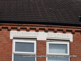
Over on facebook people are talking about plaques that appear on many Victorian houses in the town. I've long been interested in these, but rarely seem to have time to do any investigation and research that I could blog about.

In my post about Middleton Place, I mentioned the house names and the carved stone plaques, for example:

"Others (61, 63, 65 & 67) all had bay windows, were slightly taller than 53-59, with rounded arches over the doors, and with the house name carved into shaped stone above the door (Sunnydene, Lyndene, Rosedale & Avondale)."

and:

"Numbers 77, 79, 81 and 83, have very similar doorways to 61-67 and, like 61-67, the house names – Mystrayla, Jesmond, Danesford, and Cresford - were carved into a stone block above the doorway, but these were a more plain rectangular shape."  

These names do appear in the pictures that are on my Middleton Place page, but they are difficult to see, and I haven't had a chance to take further pictures. Nor have I been able to come up with any plausible solutions as to what the house names mean, nor why they were used. To date, all I've managed to come up with is:

Mystralya - spelled Mistralya seems to be the name of an elder god in a role playing game, Never Winter Nights, specifically from the Known Lands. Now, I may be wrong here, but I think this role playing game is a whole lot more recent than the house on Middleton Place!!

Jesmond - appears to be an area of Newcastle! Is this significant to Middleton Place? I personally don't know. Oh, and there are also places called Jesmond in Australia and Canada. Now, there is a place called Jesmond Dene, an important wildlife corridor that leads into Newcastle city centre: given the house names of numbers 61 and 63, is this significant in any way?

Danesford - is a small village in Shropshire, so why would a Loughborough house be so named?

Cresford - well, there's a Cresford Road in London, and a place called Cresford in Australia and Toronto, but why there is a house with such a name in Loughborough is a mystery to me,

Sunnydene - ok so "dene" could mean a sandy tract near the sea, or a steep-sided wooded valley. Maybe this house is situated in a sunny valley?

Lynedene - this name is found as both a forename and a surname. Or, lyne is a variation on the word line or lind. Or, linden is the name for a lime tree. Looking a bit deeper, lind could be mild or gentle, a lime or linden tree, to grow, or feed, a wellspring, to give birth or to bear, soft or thin, a bird, Spring, supple, vineyard's bud, sprout, plank, etc.. 

Rosedale - appears to be the name of a city in Maryland, and is also a name.

Avondale - appears to be the name of a city in Arizona, and is also a name.

To briefly return to the plaques ...

Sometimes plaques are quite ornate, but with minimal information, like a date, or the initials of the architect or builder. Nos 85 and 87 Middleton Place have a plaque bearing a date, whereas on Ashby Road and Chestnut Street, there are plaques with initials and a date, with house names and a date, and a variety of others. 


Next time you are driving along Epinal Way, do take a look at the elaborate carving on the side of Field House - swags and green men!
Well, this started as a blog about house plaques, and has ended mentioning green men - answers to the former on a postcard please, but don't mention green men ...


Sunday, 17 January 2016

Loughborough pubs

The Windmill Inn on Sparrow Hill 


I recently caught sight of an article in the “LeicesterMercury” about pub names in Leicestershire towns. You’d have thought, as the county’s biggest town after Leicester, some Loughborough pubs would have made it into the article, wouldn’t you? But no, lots of others places mentioned, but not Loughborough. I suppose it was because the pub names they were referring to no longer exist in any Loughborough pubs.


The Old English Gentleman on Ashby Road


Ok, so fair dues, the article does say it’s going to look into the more interesting pubs names in the county, but I’m sure Loughborough must have had some of these! The newspaper goes into the possible meaning of the pub names, and their choice includes the following:

  • The Monkey Walk
  • The Globe (but not the Lamplighters)
  • The Cradock Arms
  • The Ram Jam Inn
  • The Gate Hangs Well
  • The Anne of Cleves
  • The Tin Hat
  • The Two Steeples
  • O’Neill’s
  • The Bull’s Head

The Black Lion, the Hobgoblin, now the Tap and Clapp

Then, the article moves on to a selection of pub names found, not just within the county, but across the country. Here they include:
  • The Red Lion
  • The Nag’s Head
  • The Black Horse
  • The Rose and Crown
  • The Golden Fleece
  • The Barley Mow


So, let’s have a quick look at those listed above and see if Loughborough has, or had any pubs with these names:

The Bull’s Head

The Bull’s Head [and Posting House] was a coaching inn on High Street (and there was one in Shelthorpe too), approximately where vice Versa, which is now a gym, is. The original signpost was one of those wonderful ones that stretched right across from one side of the road to the other. I haven’t got a photo of this, but here’s a link to one, and here’s a picture of something similar in St Ives, Huntingdonshire, taken in 2014.  

The Oliver Cromwell pub in St Ives, Hunts.
The Red Lion (the sign of John O’Gaunt)

Loughborough’s Red Lion pub was on Biggin Street. I’m not quite sure where exactly, but I think it was in the area now occupied by Timpsons, British Heart Foundation etc.. 

The Nag’s Head (an indication that the landlord kept horses, or a jibe at women?)

A pub with this name was on the site which is now occupied by Wilkinsons. Given that when the Co-op building was being built a hoard of clay pipes was found, maybe the Nag’s Head was the original smokers’ pub!

The Black Horse (was there a racing stables nearby, or is this an omen of death of a member of the royal family?)

There was a Black Horse (and commercial [inn]) in the 1800s on High Street, and also one on Woodgate. Between 1828 and 1841 the landladies were of the Mansfield family.
  
The Rose and Crown (the joining together of two of England’s most powerful emblems)

This pub has had a couple of incarnations. The original building, on Baxter Gate was replaced in the 1930s when Baxter Gate was widened, and has been the Custard Bar (and shamefully, I can’t remember if it still is called this).

The Golden Fleece (nothing to do with Jason!)

Loughborough town centre also used to have a pub called the Golden Fleece. There have actually been about three different buildings with this name, all in the general area of Cattle Market / Granby Street, the latest now being a restaurant and bar (possibly called Chapter One?). Since Loughborough was at one time part of the [wool] Staple of Calais, then I would agree that this pub name represents our involvement in the wool industry, way back.

The Barley Mow

Well, we certainly used to have a Barley Mow, on Market Street, in the double-fronted shop, one half of which is now a cafĂ©. I wonder if this was called the Barley Mow because in the distant past this area was home to Loughborough’s malting industry? In order to use barley or other cereal grains in the brewing industry or for distilling, the grains first have to be malted  (basically, dried, re-hydrated and then sprouted). This would have happened in a building called a maltings, or a malthouse, or a malting floor. The area where Iceland is now, before it was occupied by Heathcoat’s laceworks, was, I believe, the site of the old malthouse, and was ideally sited because it is here that there are many little tributaries feeding into the Woodbrook which runs very close to Iceland, under the path. A friend tells me that although the area is now called Market Street, his mother still referred to it as either Mill Lane, or Malt Mill Lane. On a related note, there used to be a pub called The Maltings, on Knightthorpe Road, which is now a Co-op, that was a relatively recent build, and replaced an old barn: was this barn a malthouse?

Some of the more interesting pub names in Loughborough include:

Bishop Blaize – Bishop Blaize was the patron saint of the trade guild of woolcombers. The emblem usually associated with this pub name is a pair of candles, or a pair of combs. The pub was at the bottom of Woodgate.

Blue Boar – this pub was in Swan Street, and demolished when The Rushes was built. The sign of the blue boar is associated with the Tudors.

Dolphin – really? Initially I thought this might have been named ironically, rather like the Sea Around Us (on Ashby Road, now the Harvester), but I’ve now decided this uses a crest from a trade coat of arms – the dolphin being from that of fishmongers. The pub was on Church Gate: whether or not there was a fishmonger nearby, I’m not sure.

Dove and Rainbow (later Bucks Horn) – according to Bill Wells*, the Dove and Rainbow was on Pinfold Street / Buckhorn Square. The name could be a reference to Noah and the floods, or it could be that it’s connected with the dyeing industry, as the rainbow was the heraldic emblem of the Dyers’ Company and at one time there were many dyeworks in the town.

The study of pub names is a huge area of research, and there are often several suggested meanings for many names; however, some meanings are quite obvious. Some examples from Loughborough include those pubs with names related in some way to royalty or nobility. Here’s a few examples: 

Royal George on The Coneries / Nottingham Road, which was probably named after George, who was Prince of Wales, and Prince Regent in 1810 when the pub was first opened, and who became King George IV after the death of his father in 1820.

Similarly, the George the Fourth on Regent Street.

The Prince of Wales in Church Gate was opened prior to 1863: perhaps this was named in honour of Albert Edward, Prince of Wales, who later became Edward VII, on account of his being Prince of Wales from 1841 until 1901?

And perhaps the Clarence Inn (later the Jack O’Lantern) was named after the First Earl of Clarence, who was Prince Leopold, Queen Victoria’s fourth son.

Maybe the Duke of York (Nottingham Road, demolished and replaced by flats) was so named after Prince Frederick, Duke of York and Albany, the second son of George III?

The Marquis of Granby (which was on the corner of Wood Gate and Packe Horse Lane) was named after John Manners, the son of the Duke of Rutland.

Other pubs are named after the trade with which they were mostly associated, so, for example:

The Blacksmith’s Arms on Bedford Square, was so named because at one time the landlord was also a blacksmith.

The Cooper’s Arms on Barrow Street would have been frequented by barrel makers, and prior to this was named the Builder’s Arms.

The Three Tuns (now the Three Nuns) on Church Gate was a reference to the crest of the company of brewers.

The Wheatsheaf, now the Orange Tree
The Wheatsheaf (Bedford Square, now the Orange Tree) was a crest from the trade coat of arms of bakers.

The Green Man (Swan Street and under Carillon Court) was also an image used in heraldry, as the Company of Distillers used a pair of green men  (as in wild, or savage men)  as supporters in their coat of arms.

We’ve already mentioned Bishop Blaize and the Golden Fleece, the Dolphin and the Dove and Rainbow.


The Stag & Pheasant on Nottingham Road

Many pub signs are also named after animals, for example, the White Hart, the Unicorn, the Fox and Hounds, the Black/White Swan, the Black/White/Red Lion, the Black Horse, the Red Cow, Stag and Pheasant, Greyhound, Hare and Hounds/Pheasant, Peacock, etc.. Some of these origins are quite obvious, but others may be misleading, for example, I would think that the Peacock was named after the Dukes of Rutland, the Manners family, whose heraldic emblem is the peacock. Others, for example, the White Hart, have royal connections, this particular badge being that of Richard II.


Well, I could go on about this subject ad nauseam, so I shall stop here, but leave you with a thought: the Blacksmith’s Arms used to be called the Black Boy. This is thought to have been a reference to Charles II, but I have a slightly different thought about this, which I will share with you sometime! 

*Wells, Bill (2014). Billy's book of Loughborough boozers.    

Sunday, 27 October 2013

Spotlight on: Ashby Road

Ashby Road

During the Victorian times, the area around Ashby Road, was a select area where lots of the more well-to-do people lived, which is one reason why many of the houses along it are quite large and fancy. Like a lot of similar towns, Loughborough grew rapidly during the Victorian era, so the population had grown from about 4,500 in 1800 to 21500 in 1900. However, towards the later end of the Victorian era, when industrialisation had really set in, homes were needed for more ordinary folk, and these grew up around Ashby Road - Oxford Street, Leopold Street, Paget Street, Station Street, - producing almost a grid-like pattern.

Decorative tilework on an Ashby Road house
On a sunny day in August, I went out and about in Ashby Road, armed with a notebook, pencil and camera. I had been prompted to do this when I had been looking for some specific residents of the town, who lived in a house called Theydon on Ashby Road, so I was interested to find out where exactly it was, or had been. Of course, by the time I came to blog about Ashby Road, I found I had several photographs I couldn’t identify, so I visited the road again in late October.
So, here I will divulge the contents of my notebook, punctuated with photos of Ashby Road as it is today, for your perusal!


Let’s start our tour after most of the blocks of shops, but starting with a few, just to put the houses into context. Heading out of town towards the Epinal Way roundabout, this is what I found on the even numbered side of the road. I’ll give you the house number and the name (if I can find it) and any snippet of information I might have found. 


Open Heaven, number 102 - shop for sale


92-94 – Trawlers Catch, chip shop
102 – Open Heaven - shop for sale


Old English Gentleman
104 – Old English Gentleman public house
106 & 108 – small terraced houses
Newer flats – presumably built on the site of numbers 110-146. On the 1891 census, houses 110-148 existed and housed a lot of families in various trades, including, machine and engine fitters, a police constable, an iron moulder, a grocer and his assistant, a framework knitter, a cotton winder, an upholsterer and a seamstress, a herb beer seller, a tailor and a woodturner.
148A – electricity sub-station
Elim Pentecostal Church (now Salvation Army)

Curiously, on the 1891 census, listed after number 148 were Hill House, Hill House Cottage and Island house.

Gap at junction with Radmoor Road

150 Ashby Road

150 – built in 1908, named Sherwood, which is carved into the stone and brick gate posts. This is now a dental surgery.
152-156 – unnamed
158 – end of row of Victorian terrace. Named Cross Haven, which is carved into stone door arch. Run by Varsity Lets 
160 – Victorian house, unnamed
162 – the last in this block of Victorian houses. Unnamed 
164-166 – pair of 1930s semis
168 - ?
170 – 1950s house
172 – 1950s house named Mehar
174 – 1950 house
176 – 1950s house
178 – 1960s house
180 – 1960s house
182 – 1960s house


Detail of terracotta relief on 184 Ashby Road
Chimneys on 184 Ashby Road
184 – Victorian property, named Redholme, used as university halls. Carved terracotta tile depicting the date 1888 and possibly a green man with elaborate fruit beard. In 1891 Mrs Elizabeth Harley, her daughters and a servant were living here. This was once the home of Henry Clemerson, Mayor and owner of Clemerson’s Store.

In 1891, the property next to Redholme was Burleigh Fields House, the home of Dr Eddowes.


186 Ashby Road


186 – Victorian detached property, named Iffley, believed to be university halls. Double-width iron gates at the front. Once the home of Dr Herbert Schofield, Principal of Loughborough College / University, 1915-1950.


Detail of terracotta tile showing date and initials


188 – Victorian detached property, with modern university halls in the grounds. 1900 and the initials WM carved terracotta tile on the brickwork, presumably, William Moss


190 – Victorian property, renovated and with modern extension. Abbeyfield homes

192 Westfields Ashby Road Oct 2013

192 Westfields Ashby Road Aug 2013
192 – Victorian property. Name not visible but believed to be called Westfields. Currently university owned but for sale (August 2013). 1917 the owner was Mr Ernest Chapman, father of two sons (Hubert Frank, and John) who died during WW1. I believe Ernest Chapman (full name John Ernest Theophilus Chapman, a commercial traveller, whose wife was Elizabeth A Cumberland) had inherited the house from his son John. At the time of his death on 18th March 1965, Arthur Riste Clemerson, of Clemerson’s department store, was living here. When I walked the road again in October 2013 a sympathetic renovation was well underway.  
194 – detached, renovated Victorian property. University owned? Name not visible but believed to be called Essex Lodge. In 1891, Mr John Burgess, official receiver and solicitor was living here.
196 - very large Victorian property owned by university, but appears to be unoccupied, joined to 198
198 Ashby Road


198 – very large Victorian property owned by university, but appears to be unoccupied, joined to 196


200 – large cream house
202 – large, former Registry Office, now offices for PACE and debt office agency
204 - small white detached house
206 – small white detached house
208 – semi with 210
210 – white semi, attached to 208
212 – semi with 214
214 – rendered pale yellow semi, attached to 212
216 – Crossways, a large white house on corner of Ashby Road, Epinal Way and Westfield Drive.


On the other side of Ashby Road, where the odd numbered houses are, this is what I discovered.

69-71 – new building housing Language College
73 – Donkey Lets
75 – Pizza and kebab Shop
Corner newer build – Ginns & Gutteridge, funeral directors

Gap at junction with Regent Street

Generous Briton from Regent Street


85 – Generous Briton
91 – Your Smile dental surgery
93 – Nicholas Humphreys estate agency. In 1911 this was a grocers, run by Mr Thurman.
95 – Swanswell.


Gap at junction with Hastings Street

St Mary's Roman Catholic Church


St Mary’s Roman Catholic Church, 97 Ashby Road, is situated between Hastings Street and Storer Road, and fronts onto Ashby Road. The church was originally built in 1834, and was extended and enlarged in 1925. The current building is Grade II listed.


Gap at junction with Storer Road

103 - 113 Ashby Road
99 – The Laurels – name carved into the stone gate pillars
101 – possibly Holly Hurst – name carved into the stone gate pillars. In 1901 this was the home of Thomas Webb, a solicitor.
103 – Norwood Electricals – something carved into stone gate pillars, but not legible
105 – Ashby House – name on iron gates, once the home of a church clerk.
107 – Sports physiotherapists
109 – unnamed house
111 – more modern flats
113 – not evident but number 111 buts up to number 115
115 – Victorian with later additions
117 – Victorian terrace with no apparent name
119 – Victorian terrace with no apparent name
121 – New Life Guest House

Tile on the side of 123 Ashby Road
Chimney and tile on 125 Ashby Road

123 - Victorian terrace with no apparent name, but a pretty carving to the side wall

125 - Victorian terrace with no apparent name, in 1901 inhabited by Quails the drapers, and in 2013 by Jeff Jones and Kevin Norman


 127 – High Gables, detached Victorian house, now Kingscliffe Nursery, established 1999. In 1901 this was the home of Jemima Mounteney, a coal merchant. 
129 - detached Victorian house with no apparent name
131 – Ash Hyrst on stone gate pillar, although number 135 has the name Ash Hurst carved above its doorway.
133 – possibly joined to number 131

Ash Hurst, number 135 Ashby Road


135 – corner of Ashby Road and Cumberland Road – the wooden door plaque is named Ash Hurst


View of number 137 from Cumberland road


Gap at junction with Cumberland Road


137 – opposite corner of Ashby Road and Cumberland Road, the start of a row of Victorian terraces. Built 1900 and monogrammed carving on chimney stack – definitely includes the letter W and possibly an F or a J


137 - 147 Ashby Road


137-147 – a row of Victorian terraces. In 1911 number 137 was lived in by Frank Robert Louth Atkins, a surgeon, number 139 by Rowland Hibbins, a booktmaker, number 141 by Sophia Hews, a widow living on her own means, 143 George Gregg, a boot manufacturer, number 145, by Henry John Deane, a solicitor, and 147 by the Reverend James Sturdee. 


149 Ashby Road


149 – detached Victorian house with the date 1889 carved in stone. In 1911 this house may have been called Hillthorpe and inhabited by Arthur Cumberland, a grocer.  


Rear of 151 Ashby Road


 151 – Cambria House – very large detached Victorian house next to Rosebery Way, believed to be the home of a local solicitor. This property may have been called Steeton on the 1911 census and inhabited by James Cartwright a retired hosiery manufacturer.


Development on the site of 153-203 Ashby Road


Next there is a new housing development, presumably on the site of 153-203. In 1861, before the next property, The Grove, was a lodge and a toll house. In 1911, the gardener, Alfred Greaves, lived in Grove Lodge, and the Reverend Edmund Eddowes lived at the Cottage. 

The Grove


The Grove – nestled amongst the Harry French university halls of residence. This was once the home of the Middleton banking family and Beardsley the solicitor.  


205 – 1950s white detached house
207 and 209 – a pair of pale brick semis
211 and 213 – a pair of 1950s red brick semis
215 – a 1950s pale brick detached house
217 – Woodbury Lodge, a detached bungalow
219 – 1950s detached white house

Going beyond the Epinal Way roundabout towards Ashby, the housing is more sparse:

Bastard Gates entrance to the university


To the left is the university campus, with its former main entrance - Bastard Gates – so named because they were gifted in 1934 by William Bastard, a JP and later Chairman of the Governors of the university.


Field House from Epinal Way


On the right hand side of the road is first Field House, which was the home of the Burder family from 1891 to at least 1911, and was purchased by Loughborough College in 1933 as a boarding house for girls attending the Junior college School. Notice the same green man and beard carving as at number 184 Ashby Road.


Older house on the William Morris site


Next, the area known as the William Morris Hall, which consists of several older houses, including Somerton, Ashby Lodge, Highfields and Clavering, and some newer halls. I’ve got a feeling these house names might be newer than 1911, as I’ve only found Mancunian, Highfields, Gyseboro, and Elmfield on the 1911 census.

Older house on the William Morris site


As with most of my posts, this is a work in progress: I’ve not had time to find more information about the even numbered side of the road, and I’m not happy about the layout! If I do ever get any further with my research, you will be able to read about it on this blog. And I never did find the house called Theydon! Ah well, maybe one day.

See you next Sunday!